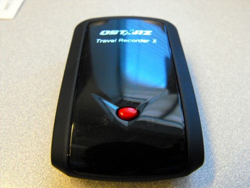
While most people use either a car style GPS, a handheld style GPS or a phone with integrated GPS, this is a device that’s a little different. Like the Visiontac VGPS-900, the Qstar BT-Q1000X is a data logger device primarily, but can be used as a navigation device via bluetooth or USB. A data logger GPS primary function is to log where you have been. It is not as concerned with presenting data during your trip, but it’s more for creating a travel log of the places you have been.
Hardware
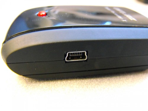
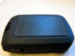
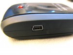
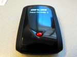
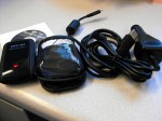
This little device is about the size of a big pack of gum. It’s very tiny and can hide almost anywhere in a car, a backpack or simply in your pocket. It comes with a case, a USB cable, CD software, and an auto power adapter which can be used to power or charge the device. The nice thing is it uses a standard Mini B cable – a type of cable which I have collected more of than I REALLY need. This means it will be easy to find a new cable if you lose yours.
When you connect the Mini B USB cable to it the device works just like a serial device and can be used with any NMEA compliant software package. If it can read from a COM port or Bluetooth, then the software can be used with this device.
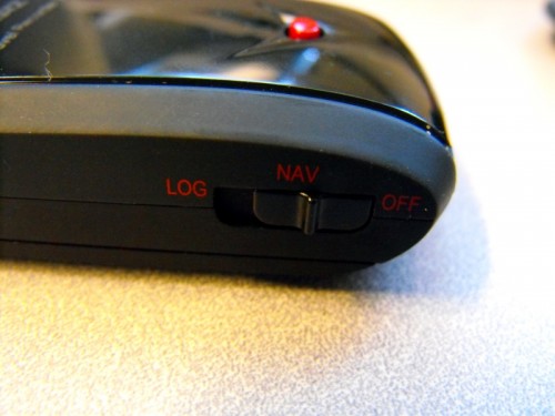
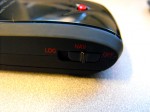
The controls on this device are very simple. There is a POI (Point of Interest) button and there is a switch to turn it on and put it into its two modes. In Log mode, the device will log where you have been as well as use the GPS for navigation while Nav mode turns the logging off and lets you use this as a traditional wired or Bluetooth connected GPS.
The BT-Q1000X gets fast position acquisition times thanks to the AGPS(Assisted GPS) feature which goes out to the internet to get data from Qstarz server. I assume that this is just ephemeris data. Ephemeris data is simply the orbital tracks that each satellite in the GPS constellation moves over the earth. Knowing this data, the GPS receiver can look for the satellites in expected positions in the sky and get a much faster fix. This data lasts for about 5 days after which the device will expire it and default to hunting the sky for the satellites. The difference between when you have AGPS data and when you don’t is striking with initial fixes at power on taking as little as 5 seconds with the data to as much as a minute and a half without.
Software
The included configuration software is Windows only, but it also comes with programs for Windows Mobile or Symbian Devices.
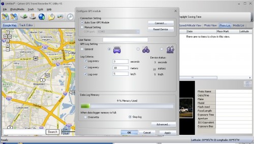
It can be configured to record your position as often as 1 fix per second, and you can also adjust that setting easily with three preset modes. Car mode takes a fix every 3 seconds, every 10 meters or every time you go over 5 km/h. Bicycle mode takes a fix every 5 seconds, every 5 meters or every time you move. Hiking or walking mode will record your position every 10 seconds or every 1 meter.
If this frequency aren’t often enough, then you can use the general setting and configure the GPS to take fixes as often as you want or as seldom. It should be noted, however, that the more often a fix is taken the faster the battery will drain.
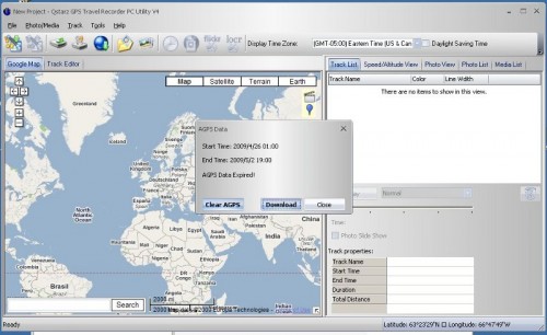
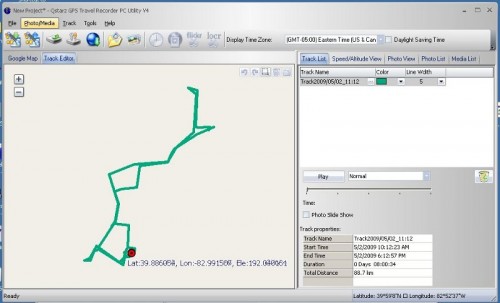
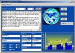
The Qstarz GPS Travel Recorder PC utility v.4 was on the small CD the GPS comes with. (The Qstarz site has an update to version 5 that fixed some of the bugs I was seeing, but not all of them.)
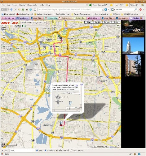
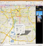
The software allows you to pull data off of the device and import them into the Qstarz GPS Travel Recorder PC utility. You can also add pictures to the project if you would like. Unlike the VGPS-900, the only time you need to press the POI button on this device is if you want to mark a POI. The Qstarz GPS Travel Recorder PC utility will add a POI pushpin to the map whenever you press this button and you will see this when you export the data as well.
Geotagging
This GPS also supports geotagging. However, I tried and tried to get the geotag feature to work the way I thought it should. What I thought is that it should look at the time in the EXIF data and finding the closest point along the track. It did geotag the pictures on the track, but the tag was no where near where the pictures were taken. There is a setting to group pictures if taken a certain distance apart and an amount of minutes the EXIF data can vary from the track, but try as I might, this always lumped the pictures near the end of my track and gave all the pics the coordinates of that data point. Maybe I need to travel farther away between pictures? Not sure.
After you have the track recorded, pictures taken and whatever other media you have recorded or collected, you can import this all into the software. Then you can export it to a html file with a folder of images, a mht file so you can e-mail a web page to s0meone, kml or kmz files for Google Earth, a GPX file, a NMEA file or a Excel file (CSV, Comma Separated Values). That’s good because the only way you can get data off the device is via this Windows only software. It does not mount as USB attached storage and is not upgradeable. The software will let you configure the GPS to overwrite tracks or not so you won’t have to worry about overwriting your track. How fast does this storage get ate up? Well the trip to work this morning I configured it to fix every 1 second and I had used 8 percent of it’s memory. That was about a 45 minute trip so I figure you will have about 562 minutes of logging before the log is filled up. That’s about 9 hours before you will have to get the logs off the device and save it. That’s with a fix being recorded every second. You can extend the logging time by increasing the time between fixes.
The software can also do something to fix drift. Drift is easiest to see when stationary. Your fix won’t stay in one spot and will vary as much as 50 ft. The software will help take out extraneous points that the device has recorded and bring your track closer to what you expect. This will smooth out your track and make it closer to what you did in real life.
This device will log for an amazing 42 hours before the battery is dead. This will vary depending on how often you are recording fixes. I have yet to exhaust the battery in this device and have even left it on for over 24 hours.
Other Software
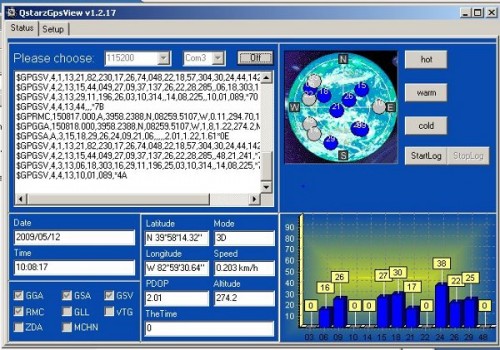
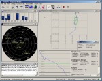
The BT-Q1000X also came with some other software, too. First is the simple QstarzGpsView. While connected to your computer, this program will show you all sorts of interesting data about how good your signal is, what kind of fix, where the satellites are overhead and more. This is a viewing application primarily. There’s no provision for saving any of this data with this software. You use the logging feature and other software for that function.
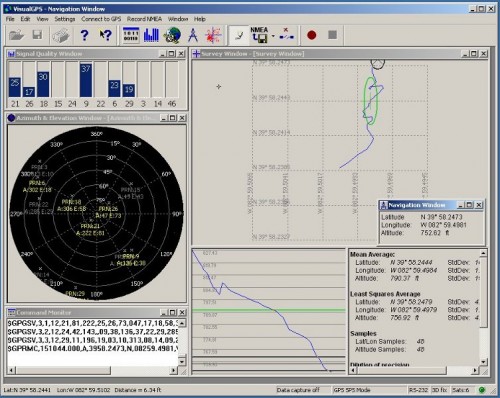
There is also VisualGPS which will present some of the data that QstarzGpsView presents. It will also let you record it.
Does it work with Linux?
Finally there is the Linux test. I tried using this on Linux using BT747 and mtkbabel and since the current kernel on Ubuntu Jaunty does not have the cdc-acm kernel module. Martin Michlmayr has instructions on how to compile a kernel module under Debian or other Debian based variants which you could probably adapt to your favorite distro. You can do that, or wait or upgrade to a 2.6.29 Linux kernel. Eventually, all distros will upgrade to this kernel so Linux support should be fine on mtkbabel and maybe BT747. The only thing I am not sure of is how to configure the logging feature. So for now, I am using a VirtualBox VM and am passing this device to the Windows XP VM I use and it works fine.
The Qstarz BT-Q1000X is available on Amazon.com for $99.95.
What I liked: Simple to use. Unobtrusive in operation.
What I didn’t like: Non upgradeable storage and no easy way to get this working on Linux is a negative in my book. If they had used Java to write it’s application, once the cdc-acm driver is there, you should be able to get the data off the device. Logging to a CSV file on SDHC storage and mounting via USB storage is a better way.
